Cloudisworks
You are using Navisworks and lately you have come into contact with laser scanning data that you need to use in your Navisworks model. Laser scanning is used more and more often in the world of Process and
Power, especially with existing sites and buildings.
Unitec understands the challenges that you are facing and created a neutral Navisworks interface, called Cloudisworks, for importing the most common laser scan data (ASCII/Las). Cloudisworks is capable of
working with large data volumes, as it by default supports multi-core processor technology.
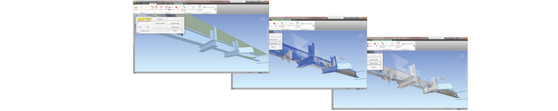
In many projects, to fulfi ll all legal obligations, it is necessary to document the “As Built” situation. With Cloudisworks you will be able to make a comparison between the As Built and As Designed situation, this
to help to determine what needs to be modeled.
Cloudisworks lets you select objects and use these objects to load dedicated parts of the Point Cloud, enabling you to work with large data volumes. Users will be able to see the current situation, without the
need to load the entire model. Cloudisworks is the perfect enhancement for users that want to work more efficiently with Point Clouds in Navisworks.
Main functionalities
- You have the choice to build-up the model using the original colors, a higher intensity value or a mis match color setting to see the differences.
- Adjustable Sampling rate to control the required density.
- Selected points will be converted in cubes or spheres, were you can set the sphere diameter or edge length manually.
- When converted to spheres, the faceting factor can be set.
- Creating sections using coordinates or parallel converting of the entire point cloud in quadrant spaces by entering start point and offset.
- All converting can be done batch wise, this makes the visualization and analyzing of laser scan data and point clouds simple, fast and inexpensive!
- You also will be able to load Point Clouds effectively into Navisworks